Showing posts with label Illustrated maps. Show all posts

Monday, May 29, 2023

On Display in the State Library

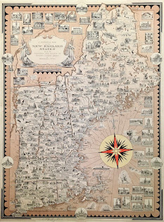
Happy June! Now that the summer months are upon us, Boston will become even busier with visitors. Whether you are a local playing tourist for the day, or an out-of-towner experiencing the city for the first time, our displayed item will provide some inspiration for things to do and places to see. Visit us throughout the month to see the Ernest Dudley Chase map Boston and Vicinity: A Pictorial Map on display in our main reading room.  

Ernest Dudley Chase was born in Lowell, Massachusetts in 1878 but lived most of his life in Winchester (which case be found at the top center of this map). He was an illustrator who was known for his greeting cards and his pictorial maps. Pictorial maps will not help you out very much if you are trying to figure out how to get from one location to another, but they will entertain you with their whimsical illustrations and depictions of an area. While many of Chase’s maps focus on New England, he did not limit himself to the region. The State Library holds several of Chase’s maps in our collection, and while not all of them have been digitized yet, you can explore a full list here. Many of Chase’s maps focus on New England, but you can see from our holdings that he did not limit himself to the region. Maps in our collection include world maps, other locations within the United States, European countries, and themed maps - like “love” and “peace.” You can also explore more of Chase’s life and work in our 2009 online exhibit Ernest Dudley Chase: A Worldview in Maps.

Our displayed map of the Boston metro area is so detailed that each time you look at it, you are bound to find something new. It is peppered with illustrations of buildings, landmarks, train routes and various modes of transportation, and bodies of water. The map extends north to Melrose, Lexington, and Concord, west to Wayland and Natick, and south to Needham, Mattapan, and Wollaston. Boston Harbor and Thompson’s Island, South Boston, East Boston, and Revere are shown to the east. Countless numbers of schools, churches, municipal buildings, and libraries are among the illustrated buildings,  along with recreational related sites like golf courses, yacht clubs, and beaches and amusement parks. For those who want a little bit of history included in their maps, Chase even included the route of Paul Revere’s midnight ride! He’s depicted on horseback leaving Old North Church, and then you can follow the horseshoe tracks all the way to Concord (the map does not address that William Dawes and Samuel Prescott were also part of this ride, and that Revere was detained and didn’t make it all the way to Concord!). 

Whether you are visiting the Boston metropolitan area for a week-long vacation or just looking for inspiration for a daytrip, you can find numerous destination suggestions in this map. And be sure to stop by one of the featured locations, the State House, to visit the State Library and see this map on display through June 27. 


Elizabeth Roscio
Preservation Librarian

Monday, February 28, 2022

Currently on Display in the State Library

This month, we’re excited to remind you that you can now visit the library and view our featured collection item in person! Currently on display in the State Library’s reading room is A Pictorial Map of the New England States, U.S.A. by renowned cartographer Ernest Dudley Chase. Dating to 1939, it is an illustrated map of the six states that comprise New England: Connecticut, Rhode Island, Massachusetts, New Hampshire, Maine, and Vermont.

Read about this map in our previous blog post, and then visit us to check out all its intricate details in person. The State Library is open to the public Monday through Friday from 9:00 to 5:00. The public can access the State House through the Ashburton entrance and be sure to check the requirements for entry before you visit. 

For those of you who can’t visit us, we’d also like to share a few of the other Ernest Dudley Chase maps found in our Special Collections.

Above left is France as drawn by Ernest Dudley Chase in 1935. This map has a fleur de lis border and shows an illustration for each French town. Paris has an illustration of the Eiffel Tower, the Arc de Triomphe and Notre Dame. There are also illustrations of landmarks flanking the map. And above right is The United States as viewed by California (very unofficial). A California-centric map “distorted and drawn” by Ernest Dudley Chase in 1940. It shows planes, trains, cars, and buses speeding across the rest of the country on the way to California, and we appreciate the annotation for New England that it is “kissed by the sun part of the time. After all, many Californians, or their forbears, came from this section.”

And lastly, published by the Massachusetts Department of Commerce and Development in 1956 is Historic Massachusetts, a travel map to help you feel at home in the Bay State. The map identifies Massachusetts as “a world of fun and relaxation” and it includes illustrations of the state’s landmarks and activities, along with an inset of Greater Boston. A useful tool for any tourist!


We’ll be changing the library’s display case at the beginning of each month, so stay tuned to see what other items will be exhibited in the months to come. And as always, we’ll continue to share the featured item through our blog and social media for those who can only visit us remotely.


Elizabeth Roscio
Preservation Librarian

Monday, November 29, 2021

On Display in the State Library

This month, our featured collection item is a fun map found in our Special Collections holdings. A Pictorial Map of the New England States, U.S.A. is by renowned cartographer Ernest Dudley Chase and dates to 1939. It shows, in great detail, the six states that comprise New England: Connecticut, Rhode Island, Massachusetts, New Hampshire, Maine, and Vermont.

If you were looking for a topographical map of New England, or a map that would show you how to get from point A to point B, you may want to look elsewhere. But this map is an excellent example of an illustrated map, which takes a more artistic, and less technical approach to cartography. Towns and cities are identified within each state and are accompanied by a drawing of an important building or landmark associated with that location. New England’s many lighthouses dot the coastline and various sailing vessels are found in the Atlantic. A fun aspect of this map is that sprinkled throughout it are illustrations of activities that can be enjoyed in that area; take a close look to see drawings of ice fishing at Sebago Lake in Maine, sunbathing at Falmouth on Cape Cod, and skiing in Gorham, Vermont. These are just a few examples, what other drawings do you spot within the map? Additionally, along the outer edges of the map are slightly larger drawings of important buildings with a title identifying their name and location, and found on the perimeter of the map, distinguishable by oval frames, are drawings of each state’s capital building - including our very own State House. 

Detail image of Cape Cod, Massachusetts
Ernest Dudley Chase was a prolific illustrator and cartographer from the early to mid-1900s. The State Library holds several of his maps in our collection, and we hope to have them all available digitally in the future, but for now a full list of our Chase holdings can be found here. As you can see, his maps were not limited to New England, but include world maps, other locations within the United States, European countries, and themed maps. 

For a high-resolution version of this New England map, please click here to explore the copy in Harvard’s map collection. There is a lot of detail to be found on this map, each time you look at it you can find something new! Zoom in on this digital version to see all of the intricate drawings - buildings, activities, landmarks - that make New England such a special place to live or visit.


Elizabeth Roscio
Preservation Librarian