Showing posts with label atlases. Show all posts

Monday, September 17, 2012

Massachusetts Real Estate Atlases Now Online


The State Library recently completed the scanning of forty-five real estate atlases covering communities throughout Massachusetts. These atlases are now available online through the library’s institutional repository and its Flickr site. This is part of a grant-funded project to digitize the approximately 200 real estate atlases in the State Library’s collection. The items that are now available include a statewide atlas and municipal volumes that cover cities and towns throughout the Commonwealth, from Attleboro to Pittsfield.

The image on the top detailing the area where the Mystic River and Chelsea Creek flow into Boston Harbor is from the 1892 Atlas of Massachusetts published by Geo. H. Walker & Co.

These atlases are a useful tool for genealogists, architectural consultants, and those researching the history of their homes, as they provide information about property boundaries, plot size, ownership and building shapes and materials. The image below, taken from the City atlas of Lowell, Massachusetts (published by G. M. Hopkins in 1879) illustrates properties, including mills and other industry along the Concord River in Lowell.

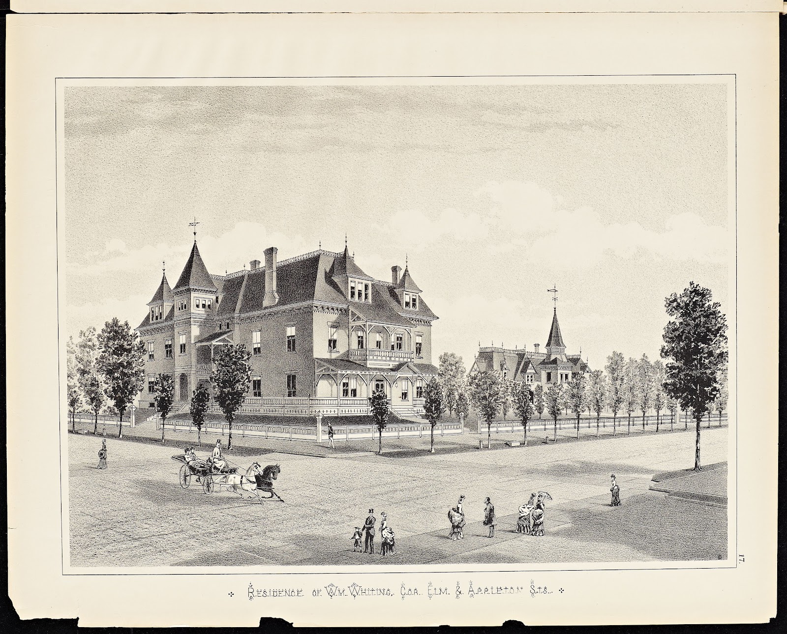
Some of the atlases also include drawings of prominent homes, schools and other important buildings. An example of this is the residence of Wm. Whiting found in the 1884 Atlas of Holyoke City, Massachusetts published by Geo. H. Walker & Co.


The Massachusetts real estate atlas digitization project, to be completed by the summer of 2013, has been developed with federal funds provided by the Institute of Museum and Library Services and administered by the Massachusetts Board of Library Commissioners.


Monday, August 6, 2012

Massachusetts Real Estate Atlases Now on Flickr


http://www.flickr.com/photos/mastatelibrary/7592839144/in/set-72157630625437496

As part of a grant-funded project, the State Library has started to digitize the Massachusetts Real Estate Atlases in its collection. The library has approximately 200 atlases, which include about 6500 maps in 12 counties and more than 80 municipalities throughout Massachusetts. These atlases provide information about property boundaries, plot size, ownership, building shapes, and materials and are heavily used by genealogists, architectural consultants, people researching the history of their homes, and others.


So far 45 of the 200 atlases have been scanned, and a selection of images from these atlases may now be viewed on the State Library’s Flickr site. 

This project is supported by the Institute of Museum and Library Services under the provisions of the Library Services and Technology Act as administered by the Commonwealth of Massachusetts Board of Library Commissioners.


- The Marketing Committee