Showing posts with label Boston. Show all posts

Monday, October 9, 2023

The Story of William Blackstone, Boston, and the Apple in North America

Happy fall, everyone! As a New England resident, one of my favorite fall treats to enjoy is a crisp apple from one of our many local apple orchards. Nothing says “fall in New England” more than a freshly picked apple (other than a pumpkin spiced latte of course). Do you know the history of the apple in the United States though? Today we’ll tell you the story of Reverend William Blackstone (or Blaxton) and how he brought the apple to this country.

Image courtesy of Boston Magazine

Blackstone, born in Lincolnshire, England around 1595, was an early colonial settler with an interesting story. His mother passed away when he was a young boy. In 1621, he was ordained by the Church of England and then lost his father not long after. Left alone in England without parents, he heard of the Plymouth and Jamestown settlements and decided to make his way across the ocean for a new life, along with his collection of books. He arrived in what is now Weymouth, MA in 1623. The Weymouth settlement didn’t last long, and in 1625 the other settlers who had been with him traveled back to England. Blackstone, however, moved north to present-day Beacon Hill in Boston and lived there by himself for five years on the Shawmut Peninsula, becoming the first European settler in Boston.

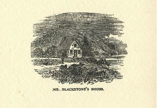
Image from Rev. William Blackstone,
the Pioneer of Boston

In 1629, Isaac Johnson, one of Backstone’s fellow students from Emmanuel College (Cambridge), and the Puritans landed in nearby present-day Charlestown. The land was rocky there, making it difficult to tap wells. Knowing the difficulties they were facing, Blackstone wrote a letter to Johnson, letting them know about the natural spring on the land that he was living on and invited them to settle there. On September 7, 1630, the Puritans took Blackstone up on his offer, leaving Charlestown and settling on the land Blackstone was living on. Only a couple weeks later, on September 30, 1630, Johnson died and as his last act as the leader of the Charlestown community, he named the new settlement “Boston", after his hometown of Boston, Lincolnshire. Eventually the number of settlers grew in Boston and Blackstone decided to sell his parcel of land to the city. That land became a town common, where cattle were free to graze. Today, this land makes up most of Boston Common. It was on today’s Boston Common land where Blackstone planted the first apple seeds in the colonies. Historians also credit him with the nation’s first apple orchard, which grew in Boston Common sometime in the 1620s.

Image from William Blackstone,
Boston's first inhabitant

Upon leaving Boston in 1635, Blackstone moved to present-day Cumberland, Rhode Island a year before Roger Williams arrived. He married at 64 years old and had a son a year later. On May 26, 1675, Blackstone died in Cumberland, RI, where he had settled 40 years earlier. Today you can visit the Founders Memorial in Boston Common, which shows Blackstone greeting John Winthrop and inviting him and his group to the Shawmut Peninsula. You can also visit Blackstone’s grave in Cumberland.

Image courtesy of Digital Commonwealth via
Boston Public Library

Blackstone came to America and, as author Thomas Amory wrote of him, “here he dwelt, solitary and alone, raising apples and roses, and reading his books, of which he had a plentiful supply.” He was an interesting figure in history and if you’d like to learn more about him, feel free to reach out to us at reference.department@mass.gov and/or look through some of the resources below.

Works consulted and other articles of interest:


Jessica Shrey
Reference Librarian

Monday, May 29, 2023

On Display in the State Library

Happy June! Now that the summer months are upon us, Boston will become even busier with visitors. Whether you are a local playing tourist for the day, or an out-of-towner experiencing the city for the first time, our displayed item will provide some inspiration for things to do and places to see. Visit us throughout the month to see the Ernest Dudley Chase map Boston and Vicinity: A Pictorial Map on display in our main reading room.  

Ernest Dudley Chase was born in Lowell, Massachusetts in 1878 but lived most of his life in Winchester (which case be found at the top center of this map). He was an illustrator who was known for his greeting cards and his pictorial maps. Pictorial maps will not help you out very much if you are trying to figure out how to get from one location to another, but they will entertain you with their whimsical illustrations and depictions of an area. While many of Chase’s maps focus on New England, he did not limit himself to the region. The State Library holds several of Chase’s maps in our collection, and while not all of them have been digitized yet, you can explore a full list here. Many of Chase’s maps focus on New England, but you can see from our holdings that he did not limit himself to the region. Maps in our collection include world maps, other locations within the United States, European countries, and themed maps - like “love” and “peace.” You can also explore more of Chase’s life and work in our 2009 online exhibit Ernest Dudley Chase: A Worldview in Maps.

Our displayed map of the Boston metro area is so detailed that each time you look at it, you are bound to find something new. It is peppered with illustrations of buildings, landmarks, train routes and various modes of transportation, and bodies of water. The map extends north to Melrose, Lexington, and Concord, west to Wayland and Natick, and south to Needham, Mattapan, and Wollaston. Boston Harbor and Thompson’s Island, South Boston, East Boston, and Revere are shown to the east. Countless numbers of schools, churches, municipal buildings, and libraries are among the illustrated buildings,  along with recreational related sites like golf courses, yacht clubs, and beaches and amusement parks. For those who want a little bit of history included in their maps, Chase even included the route of Paul Revere’s midnight ride! He’s depicted on horseback leaving Old North Church, and then you can follow the horseshoe tracks all the way to Concord (the map does not address that William Dawes and Samuel Prescott were also part of this ride, and that Revere was detained and didn’t make it all the way to Concord!). 

Whether you are visiting the Boston metropolitan area for a week-long vacation or just looking for inspiration for a daytrip, you can find numerous destination suggestions in this map. And be sure to stop by one of the featured locations, the State House, to visit the State Library and see this map on display through June 27. 


Elizabeth Roscio
Preservation Librarian

Monday, March 22, 2021

Old Photographs of Boston

During a major cataloging project at the State Library, the staff rediscovered many of our beautiful collections, including maps, photographs, and manuscripts. These collections are now fully cataloged and can be found in our online catalog.

One of my favorites is the “Photographs of Old Boston” collection, which we were able to digitize and can be found in the Library’s digital repository, DSpace or through the Library’s Flickr page.

Public Garden, 1857
This album was acquired by the State Library from G.H. Marsh in 1907 and consists of 49 black and white photographs that provide views of Boston during the 19th century. It shows historic buildings, storefronts, cathedrals, and well-known Boston sites like the Garden and the Old State House, as well as places that no longer exist like the John Hancock house. What is interesting about these photographs is how certain places have changed but also how they have remained the same.
John Hancock House,
1860

 You can access the full collection from either   DSpace or the Library’s Flickr page.


 Silvia Mejia
 Special Collections Librarian
 State Library of Massachusetts


Tuesday, April 21, 2015

Poetry for Boston

April is National poetry month and Massachusetts has a number of famous poets who were born, raised, educated or lived their lives in our cities and towns. Robert Frost, Ralph Waldo Emerson, Emily Dickenson and Stanly Kunitz could all call Massachusetts home and many wrote poems and stories inspired by the people they knew, places they lived and scenes they saw. The State Library of Massachusetts has a number of these poets’ works in our collection as well as biographies and compilations.

In honor of National Poetry Month, I went looking through our catalog for poets or specific poems to highlight. While searching, I came across a number of poetry books with a focus on the city of Boston. I was struck by the broad range of the subjects, authors and tones of these poems, each celebrating (and at times even lamenting) the same city. The three books I chose to further concentrate on for this blog where picked for their drastically different styles and years that they were written or published.


Poems of the "Old South" is a volume of poems published in 1877 by William F. Gill to help raise funds for the preservation of the Old South Church, also known as The Old South Meeting House. “Old South” was originally built in 1729 as a Puritan meeting house where people assembled up through the American Revolution. In 1877, the church was nearly demolished but was saved when it was established as a museum and Poems of the Old South was put together so raise money for preservation work needed at the time.

Most of the poems in the collection praise the church and its historical significance to Boston. Many of the poets regard it as a symbol of liberty due its connection with early colonizers who came to the new world. James Freeman Clarke’s poem boasts in his personified work The "Old South" Speaks that:
Though prouder domes are elsewhere swelling, 
And loftier spires salute the morn, 
Let Boston save the plain old dwelling
Where Freedom for mankind was born”

Boston in My Blood was written by Elizabeth F. Leach, a local school teacher and poet. Born in Brookline, a Boston University graduate and a teacher in the Somerville school system for 40 years, Leach was a Massachusetts native through and through.  In 1963, Leach privately printed and published the book of poetry, Boston in my Blood.

Leach’s poems have short lines that fall into simple rhyme schemes. Her poems offer witty remarks that at times may only be understood by a Bostonian. Her poems fall into distinct categories such as “Of Boston Bachelors” or “Spinsters of the Hub”.  Colleges get their own section with titles like BU? BC? BC? BU? B-Musing and The Man From MIT.  Other poems take us on a ride geographically, from Balloon Man at the Garden’s Gate to March Winds Along Boylston Street, winds that can still be felt as you walk through Copley Square.  Although published in 1963, many of the poems continue to ring true today including Subway Sputtering’s which describes subway woes at peak commuting house even 50 years ago:
When it’s Five o’clock at Park Street
As commuters mill about,  
One can hear the starters shouting,
“Let’em  out, please let ‘em out!” 
Once that last Lechmere survivor 
(We must hope that he is thin)
Has descended, comes the struggle, 
“Let’em in, please, let’em in!”

After the Boston Marathon Bombing in April of 2013, Deborah Finkelstein, a poet, playwright and professor, wanted to help. Like One: Poems for Boston is an anthology of poetry created to raise money for The One Fund, a charity for Boston Marathon victims. Finkelstein chose works from many well-known poets such as William Carlos Williams and Walt Whitman, but also has a large selection of modern writers as well.

What is incredible about Like One is that while a few pieces mention Boston, it is not a book focused on the city or the bombings per say. Instead, it brings together a series of poems that inspire unity and healing, like what happens to communities after a tragedy. Part of the reason for this feeling is that Finkelstein encouraged poets and people to send in poems that have lifted their spirits in their own lives. At the end of Jill McDonough’s poem Accident, Mass Ave., a piece describing a minor accident between herself and a woman, she writes after the two have yelled and swore at each other:
Well, there’s nothing wrong with my car, nothing wrong
with your car…are you Ok? She nodded, and started
to cry, so I put my arms around her, and I held her, middle
of the street, Mass. Ave., Boston, a couple blocks from the bridge.
I hugged her, and I said We were scared, weren’t we?
And she nodded and we laughed.”

McDonough finds a perfect way to describe the fear that was felt in the city at the time of the bombings and how we found ways to heal, whether it was with poetry or each other.

Check out more information for National Poetry month here. For events in Massachusetts see the Boston National Poetry month Festival and Massachusetts Poetry Festival.

Stephanie Turnbull
Reference Librarian

Monday, November 10, 2014

Early Boston City Documents Relating to the Pure Water Issue

As the city of Boston continued to develop and increase in population, supplying pure water to the city “for the domestic use of the inhabitants, as well as for extinguishing fires, and for all the general purposes of comfort and cleanliness”* became a pressing issue.

Earlier attempts by private developers had been made to address the need for an enhanced public water works, including the 1795 legislative approval for “The Aqueduct Corporation” to oversee the laying of “subterranean pipes” that would route water to Boston from Jamaica Pond in Roxbury.  In 1816, a preliminary look into routing additional water from Spot Pond in Stoneham was found “inexpedient.”

It wasn’t until May of 1825 that Boston’s city government first took action on the water issue and formed a commission, which was chaired by then-Mayor Josiah Quincy, Jr.  That same year, the Water Commission was authorized to conduct a survey to collect information, and Professor Daniel Treadwell, one of its appointed members, issued the first of many investigative reports that would survey Boston’s nearby freshwater sources and estimate the feasibility and probable costs of transporting water to the city.  Some of the later reports, authored by subsequent Boston commissions and by various civil engineers, included maps, plans for proposed pipelines, and examples of other domestic and foreign public water works.  The State Library has many of these reports within its collection, as well as additional Boston city documents, communications, and citizen testimony pertaining to the water supply issue during the 19th century.

"Plan of a proposed route of pipes from Spot Pond in Stoneham to Boston," issued in the 1837 report of the city's Water Commission. Spot Pond was one of the options Boston considered in its surveys of pure water sources.


One valuable resource compiled by a member of Boston’s Water Board, titled History of the Introduction of Pure Water into the City of Boston (1868), is available online and provides an early history on the delivery of pure water into Boston.

A past exhibit by the State Library, titled “The Time of Action Has Come”: Introducing Pure Water into the City of Boston, can be viewed online, and chronicles the history of Boston’s water supply up through the 20th century.

For further information regarding Boston’s water documents, please contact the library by phone at 617-727-2590, or by email at reference.department@state.ma.us.  The library is open from 9am to 5pm Mondays through Fridays.

*Quoted from Daniel Treadwell’s 1825 report to the mayor and alderman of the city of Boston.

Kaitlin Connolly
Reference Department

Monday, April 14, 2014

Some Mayors of Boston who had been members of the General Court

Martin J. Walsh
On January 6th of this year, Martin J. Walsh became Boston’s 54th Mayor. Walsh had had a long career in state government, having served in the Massachusetts House of Representatives from 1997 until his swearing-in as Mayor. He follows a long list of Mayors of the city who were also in the Massachusetts legislature. When he was in the House of Representatives, Walsh represented the 13th Suffolk District. He had been elected in a special election in 1997 and was in that seat until his resignation on January 3rd of this year.

Raymond Flynn
Mayor Raymond Flynn, elected in 1983, was the city’s 52nd Mayor. He had represented the people of the 7th Suffolk District in the House of Representatives from 1971 through 1979. In 1978 and for the years directly before he was elected Mayor, he was a member of the Boston City Council. Flynn became Mayor in January 1984 and served until he resigned his position after being appointed on July 1st, 1993 by President William Jefferson Clinton to serve as the United States Ambassador to the Holy See.

John F. Collins
Mayor John F. Collins was elected to two Mayoral terms and was in the office of Mayor from 1960 through January of 1968.  He was the 50th Mayor of the city.  Previously, he was a member of both houses of the General Court, in the House from January 1947 until January 1951 and in the Senate from 1951 through 1954. The House district was the 10th Suffolk and the Senate the 5th Suffolk. After leaving the Mayorship, Collins worked as a news analyst for Boston’s Channel 7 and became a Professor of Urban Affairs at M.I.T.

James Michael Curley
Perhaps one of the best known politicians from Massachusetts, James Michael Curley, served as 41st, 43rd, 45th and 48th Mayors of Boston. His years in that office were 1914-1918, 1922-1926, 1930-1934 and lastly, 1946-1950. During his last term, having been indicted for mail fraud, he was imprisoned for five months. Curley’s political path took him to the Governorship and to membership in Congress. His term in the General Court was short and covered the years 1902-1903. The District he represented at that time was known as District No.17- Ward 17.

Massachusetts is  known for its political culture and for a history deeply touched by the political process.

The State Library of Massachusetts is the perfect place to research Massachusetts officeholders, such as these examples of Mayors of the capital city.  To learn more about these four political figures and to garner much more about their careers, please visit us in Room 341 of the Massachusetts State House.


Pamela W. Schofield
Legislative Reference Librarian


Monday, September 30, 2013

Abandoned Buildings and Renovation in Boston

I recently came across a book entitled A Blight on Boston: How Shall it be Removed written by John Albree and published in 1906. The book talks about idle land and abandoned railroad property in Park Square, located near the Back Bay, on the corner of Boylston Street, Columbus Street and Charles Street where the Boston Common and the Public Gardens meet. The land was abandoned by the Boston and Providence Railroad in 1899 and by 1906 when the book was written it was still abandoned. The author describes the land as unproductive and “not earning up to its potential in taxes.” By 1906 the buildings have been occupied by an automobile dealership and by a roller skating rink with the Shubert Theater moving in a few years later on January 24, 1910. 

Park Square is no longer identified on 2013 maps but there are many businesses that use Park Square in their titles.  Some of the streets have changed. For instance Arlington Street was shorter and did not cross Boylston Street in 1906.

The abandoned Boston and Providence railroad station was replaced by South Station.  According to the South Station website it took two years to build and was dedicated on December 30, 1898, the largest rail station ever built at the time.  There were five railroads before South Station was built and only two railroad companies, the New Haven Railroad and the Boston and Albany Line survived to move into South Station.

Naomi Allen
Reference Librarian

Monday, February 27, 2012

Digitization project to make Massachusetts atlases available on the web

As part of a grant-funded project, the State Library has started to digitize the Massachusetts Real Estate Atlases in its collection. The library has approximately 200 atlases, which include about 6500 maps in 12 counties and more than 80 municipalities throughout Massachusetts. These atlases provide information about property boundaries, plot size, ownership, building shapes and materials and are heavily used by genealogists, architectural consultants, people researching the history of their homes and others.

The image on the left is from George Washington Bromley’s Atlas of the City of Boston, volume 1, published in 1883. It shows the State House before the back half of the building was added in the 1890’s and before the east and west wings were added in the early 20th century. It also shows the properties that were taken to make room for these additions.

The image on the right is from the Atlas of Hampden County, Massachusetts, published by F. W. Beers in 1870. It shows the center of South Wilbraham.

The first group of 45 atlases currently being digitized include a statewide Massachusetts atlas, atlases from Middlesex, Franklin and Worcester counties and municipal atlases that cover 45 cities and towns throughout the state from Pittsfield to New Bedford. These materials should be digitized and in our electronic repository by late spring. The entire project is expected to be completed by summer, 2013.

The Massachusetts real estate atlas digitization project has been developed with federal funds provided by the Institute of Museum and Library Services and administered by the Massachusetts Board of Library Commissioners.

Friday, March 5, 2010

Keys to the City

As an intern in the Special Collections department, I am always excited when I learn something new about the collection. A couple days ago, the preservation librarian, Lacy, showed me this key to the city of Boston. She found it in the vault in a collection of medals. When we looked through the collection again, we found another ceremonial key to the city of Lynn that was presented during the city’s tercentennial celebration. Both keys are gold in color with designs representing the city etched on each side. To give an example, the Lynn key has a pair of high heels on the handle to pay homage to the city’s history as a major center in the shoe industry.

Keys like these two are presented by the mayor to honor individuals for their civic services, or personal or career achievements. The tradition of awarding these keys stems from the Middle Ages when walls surrounded cities and travelers entered through gates. The keys represented free and easy entry into the city as well as trust and respect. I was a bit surprised by the size of the keys. When I think of ceremonial presentations I think about comically oversized checks and I expected the keys to be just as big. Each key is about the size of a skeleton key to an old house, but the key is slightly larger than the Lynn key.

I did a little research about keys presented by the mayor of Boston in the City Record. The City Record documents events and news in Boston and the activities of Boston’s mayor. In the 1925 volume, I found several articles concerning events where Mayor James Michael Curley presented keys. Two articles in particular caught my attention. One was a short note from the Chinese General Consul Ziangling Chang, thanking Mayor Curley for his hospitality and the key to his city. The other article described a visit by the Belgian ambassador to Boston. Mayor Curley presented him a key and accepted a Belgian flag in return. If you are interested in conducting further research, I suggest searching local newspapers and the Zimmer Index for articles about key recipients in Boston and other cities.

Marietta Carr, Special Collections Intern