In the State Library’s preservation lab, I work with some
wonderfully historic and awe-inspiring material. Other times, I find gems
that may not be quite as old or historically significant, but that are still valuable
resources in our collection.
In 1960, Sterling Publishing published a
volume called released Antique Maps of the World in Color - featuring beautiful reproductions of thirty-six maps, ranging
from the 16th through the 19th century. Some of the original maps were created as
single pieces; others were first published in atlases. Some were painted by hand by
the mapmaker himself, others were professionally colored. As citizens of the
twenty-first century, we expect the landscapes depicted on modern day maps to
be up-to-date and accurate, but the awesomeness of these imaginative and
interesting antique maps cannot be denied. Cartography fans and laymen alike
will appreciate not only the color and beauty of the maps themselves, but the
fascinating changing landscapes, boundaries and names of locations all throughout
the Old and New World. The book itself needs no preservation or
conservation repair – it was simply an enjoyable find here at the library.
 |
| Map of the Holy Land by Abraham Ortelius |
This map of the Holy Land created by Abraham Ortelius (1527-1598) depicts Jerusalem, the cities of Sodom and Gomorrah, the Jordan River, and the Dead Sea. The twenty-two vignettes bordering the map depict the travels of Abraham as he traveled throughout Jerusalem. His route is depicted in the small inset box.
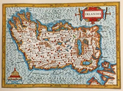 |
| Map of Irlandia |
 |
| Map of Britain by John Speed |
John Speed (1552-1629) depicts Britain’s division of seven allied districts in the year 1607. The illustrations on the sides show Britain’s history from 456 to 662 and the leaders who founded the kingdoms. On the map you can see the coats of arms representing the seven districts, in addition to the coat of arms for Wales, the harp in Ireland and the two coats of arms in Scotland.
 |
| Map of Italy and islands of Sicily, Sardinia, Corsica and Malta |
This map, issued at some point between 1700 and 1721, depicts the divisions of Italy and islands of Sicily, Sardinia, Corsica and Malta. Jean Baptiste Homann, the Nuremberg mapmaker, typically colored his maps and left the cartouches in black and white, as you can see. This particular cartouche shows Pope Clement XL and child angels.
 |
| Map of America |
Though this map is dated 1690, it was actually issued by map publisher Johann Baptiste Homann between 1717 and 1719 for Scottish economist and banker John Law’s inflated promotion of the “Mississippi Company.” Great liberties were taken with this map and it is not thought to be highly accurate. In the original map, the trees and the mountains were not done in color and the cartouches were different as well.
Kelly Turner
Preservation Librarian