In this July 4th's edition of the Boston Sunday Globe, Eric Moscowitz wrote of the 100th anniversary of the Esplanade, whose opening was highlighted with fireworks on Independence Day in 1910. The article speaks of the ups and downs with the history of this most famous of the city's landmarks.
In the 3rd floor stacks of the Library, one can find a pamphlet The Charles River Esplanade: Our Boston Treasure, published in 2000 by the Metropolitan District Commission (now known as the Department of Conservation and Recreation) and written by Linda M. Cox, Founder of the Esplanade Association. The booklet is digitized and note the link in the record to the online version. This small booklet is indeed a treasure in itself with its rich history of the site.
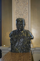
Among many other items housed in the State Library about this famous landmark are items about the flamboyant and much celebrated conductor, Arthur Fiedler, who presided at fifty July 4th concerts. An online biography of this famous conductor by PBS (WGBH Boston) includes the following about his tenure:
"Among memorable events of the Fiedler era were the Fiftieth Anniversary Esplanade concert of July 4, 1978; the building of the Hatch Shell in time for the Esplanade season of 1940; the occasion of the Maestro's seventy-fifth birthday, when his son Peter presented him a surprise gift on behalf of the whole family: an honest-to-goodness, full-size fire engine(!); and the Esplanade concert of July 4, 1976, which was heard by over 400.000 people, declared by the Guinness Book of World Records the largest single audience for a classical music concert. "
The Fiedler footbridge was designated by Resolve 86 of 1953 and in 1980, not long after his death, the General Court memorialized him. This law is available in the library and has also been digitized and can be found online with other years' Acts and Resolves.
It reads:
Chap. 567. AN ACT DIRECTING THE METROPOLITAN DISTRICT COMMISSION TO RESERVE A SITE FOR A STATUE MEMORIALIZING ARTHUR FIEDLER.
Be it enacted, etc., as follows:
The metropolitan district commission is hereby authorized and directed to locate and reserve a site for a statue at the Hatch memorial shell located in the Charles river reservation in the city of Boston, in memory of Arthur Fiedler, the father of the Boston Pops.
Approved July 16, 1980
On to another 100 years and more.
Pamela W. Schofield
Reference Department
State Library of Massachusetts
Tuesday, August 31, 2010
Thursday, August 26, 2010
Commonwealth Connector
The Commonwealth Health Insurance Connector Authority was created by Chapter 58 of the Acts of 2006.
It is an independent state agency helping citizens find an insurance plan that is right for them. The agency promotes insurance coverage for the uninsured with affordable plans. The Authority’s program has made Massachusetts a model in the United States for health care reform.
The agendas, board minutes and reports are available at the State Library in both tangible format (paper) and online. Our collection starts on June 7, 2006 and is current.
When visiting the Library in room 341 of the State House, there is access to the reports, agendas and minutes by asking for: MR 368.382M3 M56
The Reference Department
Wednesday, August 25, 2010
Crimes and Punishments in the Massachusetts General Laws
There is a long history of laws dealing with drunk people, pilferers (or people that steal) and brawlers going back to colonial times.
Chapter 272 section 53 of the Massachusetts General Laws once read: "Rogues and vagabonds, persons who use any juggling or unlawful games or plays, common pipers and fiddlers stubborn children, runaways, common drunkards, common nightwalkers, both male and female, persons who with offensive or disorderly act or language accost or annoy in public places persona of the opposite sex, pilferers, lewd, wanton and lascivious persons in speech or behavior, common railers and brawlers, persons who neglect their calling or employment or who misspend what they earn and do not provide for themselves..." The penalty for these crimes was "imprisonment in the Massachusetts reformatory or at the state farm..."
According to Massachusetts General Laws Annotated this chapter was rescinded by c. 377 of the Acts of 1943. Part of this law originated from Colonial times in Colonial Law chapter 153, section 1.
Image: first seal of the MA Bay Colony used from 1629-1686, 1689-1692.
Naomi Allen
Reference Librarian
Thursday, August 19, 2010
Preservation Milestones
The past month has been a busy and exciting one for the preservation lab!
At the end of July preservation work was completed on the items being digitized under the Mapping Massachusetts grant. In total 368 items were preserved, with a total of 2,223 repairs performed. Work began in October of 2009 and was performed by the Preservation Librarian with help from lab interns Sarah Pickard, Jay Moschella and Chessie Monks.
This week the 1,000th item from the Massachusetts Room Preservation Project(MRPP) was repaired and preserved. Work on this NEH grant funded project began in January of 2010 and will continue through the end of the grant period in 2011 and beyond. The MRPP is designed to be a multi-year project that aims to assess and preserve when needed an estimated 40,000 items in the Massachusetts Room. Work is being completed by the Preservation Librarian and many dedicated interns. These wonderful interns include Sarah Pickard, Hilary Vaught, Bianca Hezekiah, Lori Satter and Shawna Smith.
- Lacy Crews Stoneburner, Preservation Librarian
image: Harbor at Cotuit and Osterville in the town of Barnstable
Wednesday, August 18, 2010
Special Collections Hours
Special Collections will be open Monday through Friday from 9:00am to 1:00 pm through August 27. From August 30 through September 3 the hours will be 9:00am until 1:00pm and by appointment. Please call 617.727.2595 to make an appointment.
Friday, August 13, 2010
Soldiers and Sailors
The State Library has two excellent resources to find service information about infantry, soldiers and sailors who served in the Revolutionary War or the Civil War.
The first set of volumes is entitled Massachusetts Soldiers and Sailors of the Revolutionary War. This resource is available in our stacks under the call number and online.
The second set is Massachusetts Soldiers, Sailors and Marines in the Civil War. Genealogists frequently use this book to verify that their relative served, or to see which battles and in what localities a person served. The Civil War volumes contain Regimental Histories.
The books usually have information about where the person is from, where they joined the regiment, the battles in which they fought, whether they were wounded or whether they died and when they mustered out of the unit. There are no pictures in these volumes.
The Massachusetts State Archives at Columbia Point has the muster rolls in their collections.
Pictured Sergeant Andrew Jackson Smith: "Private, Res. Taunton; 21; blacksmith; enlisted Sept. 15, 1862; must. Sept. 23, 1862; must. out Aug. 28 on or about Sept. 25, 1863." Image from State Library's collection.
Naomi Allen, Reference Librarian
Wednesday, August 11, 2010
Sculpted to Inspire
The first sculpture in our series “Sculpted to Inspire” is a likeness of Theodore Roosevelt, 26th President of the United States, sculpted by John Gutzon Borglum in 1919. This piece was given to the State Library by the T.R. Club of Massachusetts* in 1945.
John Gutzon de la Mothe Borglum (March 25, 1867 – March 6, 1941) was an American artist and sculptor of Danish descent. He was famous for creating the monumental Presidents' heads at Mount Rushmore, South Dakota. Borglum met and was influenced by world famous sculptor Auguste Rodin.
Borglum did these sculptures:
● Abraham Lincoln’s head carved from a six-ton block of marble was done in 1908 and was exhibited in Theodore Roosevelt's White House. It can be found in the Capitol Rotunda in Washington, D.C.
● Borglum was asked to do a sculpture of Robert E. Lee at Stone Mountain in Georgia in 1915. He decided to do a group featuring Lee, Stonewall Jackson and Jefferson Davis on horseback followed by a column of soldiers. He finished Robert E. Lee’s head but was fired from this project in 1925. Nothing of Borglum’s work remains, since the next artist they hired destroyed Robert E. Lee’s head.
● He carved four President’s heads: George Washington, Thomas Jefferson, Abraham Lincoln and Theodore Roosevelt at Mt. Rushmore in the Black Hills in South Dakota from 1927-1941. Borglum came to South Dakota in 1924. On March 6, 1941 he died. His son Lincoln “put the finishing touches on his father’s vision” of Mount Rushmore. Borglum felt: "The purpose of the memorial is to communicate the founding, expansion, preservation, and unification of the United States with colossal statues of Washington, Jefferson, Lincoln and Theodore Roosevelt."
*Theodore Roosevelt Club of Massachusetts
Sponsored by the Friends of the Library
Thursday, August 5, 2010
Census, the Library and YOU
The State Library's census collection dates back to 1790, the first year the federal census was taken. When you search our online catalog, you will find over 200 entries about the census.
As a selective Federal Documents Depository, the State Library receives all Census Bureau publications for Massachusetts. The Library is also an affiliate of the State Data Center.
State Data Centers are cooperative programs between the Census Bureau and the states. This program ensures that the public has access to data produced by the U.S. Government, Bureau of the Census. The Data Center Program started in 1978.
In Massachusetts, the Data Center is part of the Economic and Public Policy Research unit at the University of Massachusetts Donahue Institute. The Institute is in the Office of the President of the University.
On the Library's website you will find the Massachusetts State Census results from 1855 to 1975. Be sure to search under the heading Digital Collections in the gray area for Online Services.
In December of 2010, the Census Bureau will be releasing the results of the 2010 Decenial Census.
Bette Siegel
Documents Librarian
Tuesday, August 3, 2010
Dirty Map? Clean it up!
As mentioned previously on the blog, the library is in the process of digitizing roughly 400 maps in the collection as part of a grant awarded by the Massachusetts Board of Library Commissioners. One collection of profile maps that correspond to the railroad maps are being digitized in-house and a description of the process is detailed here.
The image above shows one piece of a profile map that corresponds to the railroad map, Proposed Connections to the Massachusetts Central Railroad. All told, this particular profile map is made up of six pieces and is 191.5 inches long. There are about 70 profile maps in total, all equally long and all equally dirty! I have been working over the past couple of months to clean the dust and grime that has accumulated on these maps during years of storage in order to prepare them to be scanned and posted in the library's digital repository, DSpace.
Although the condition of the maps may look daunting, cleaning them is actually a relatively simple process. I am using non-abrasive vinyl erasers and eraser "pencils" created to erase ink from drafting film. I use a brush to sweep away the eraser crumbs, so that I do not damage or dirty the maps further by using my hands to brush the crumbs away.
I clean the maps in small sections, usually using the graphing lines printed on the maps to isolate small areas. This way, I can check my work as I go and easily see the progress I am making. Using two different erasers allows me to clean carefully around a note written in pencil or clean larger areas quickly.
In the image below, I cleaned only the section of the map below the graphed area. The difference is obvious, especially when compared to the original image of the map before cleaning (pictured above). Although the map may still look somewhat dirty, this is due to staining from the dirt and cannot be removed even if I cleaned the area over and over again.
I then move onto cleaning small rectangular areas of the graph. This ensures that I do not miss any areas and also keeps me from re-cleaning sections that are permanently stained. Too much or too vigorous cleaning can also damage the surface of the map and make the paper fragile. Most of these maps are relatively sturdy to begin with and hold up well when cleaned. Only a few have brittle edges or tears, and these may eventually be repaired with Japanese tissue to keep them from being damaged further.
I also make sure to examine the map carefully before cleaning it. In the image on the left, what may look like a smudge above the blue line is actually a number written in pencil in extremely small handwriting (click on the image to zoom in and see for yourself). The maps also often have elaborate handwritten town names and titles in ink, but it is also possible to see the original pencil draftwork done before inking the final product. We want to keep these original pencil markings intact for study even if they were mostly erased by the original creators of the maps.
The map piece at the top of the photograph at left is the final, cleaned product. Compared to another uncleaned piece of the same map, the change is easy to see. While these maps may never be perfectly spotless, if I looked this good at 140 years old, I would be pretty pleased!
The next step in the project is to scan and stitch together the pieces of the map, so that users may view them up-close and personal online. I'll share the process of scanning sometime later.
-Chessie Monks, Preservation Intern